
Monday NJ Weather: More On-and-off Rain, Wind Kicks Up Again
The Bottom Line
What a disgusting weekend, huh? The brunt of Tropical Storm Ophelia was pretty dramatic at the Jersey Shore on Saturday. Inland areas and all of Sunday were just plain wet.
Top rainfall totals have now surpassed 5 inches in spots. Especially around southern Ocean County, from Toms River to Berkeley Township to Stafford Township to Little Egg Harbor, which saw a stagnant downpour on Saturday. There's still another half-inch to inch to come from Monday into Tuesday. No complaints about the rain being spread out over multiple days, keeping the flash flooding risk relatively low.
As the center of Ophelia's remnants pass directly across New Jersey on Monday and eject into the Atlantic Ocean, it will fire up again. That will push wind speeds upward again — nowhere near Saturday's 50-60 mph gusts, but the increase will be noticeable.

And finally, we still have to watch tidal waterways along the Jersey Shore all week long. Several more rounds of minor to localized moderate coastal flooding are expected. For two reasons: 1.) Back bays are still running full with surge water, due to the persistent on-shore wind. 2.) The approaching full moon on Friday will push astronomical tides higher too.

Two more days of "blah" weather, then improvements take over midweek. If all goes well, the weekend forecast is looking fantastic.

Monday
Ophelia's raindrops arrived Friday evening. And here we are, almost 60 hours later, and it's still raining!
At the moment, we are still entrenched in rich tropical moisture. And the center of Ophelia's remnants (no longer tropical) are just to our southwest. So it is going to be another miserable day, but the threats for total washout or heavy rainfall seem slim.
Pockets of light to moderate rain will stream through the Garden State Monday. Based on the orientation and motion of the storm and model guidance, the wettest areas will be the northern half of the state and the Jersey Shore. (In other words, the I-295 corridor in SW NJ will see more breaks, more pockets of dry weather.)

The threat for flooding is relatively low. (Although the ground is saturated, lending toward "big puddles" forming.) And the risk of severe weather or even rumbles of thunder is very low.
We so have to talk about wind, which becomes a bigger part of the forecast again Monday. Gusts will pop over 20 mph inland and 30 mph coast through the afternoon and evening hours. Not enough to be damaging or overly concerning. But it will be a bit blustery, and definitely noticeable.
Amongst the raindrops and the clouds and the wind, temperatures are stuck on the cool side for the duration. Don't expect much diurnal warmup Monday, with highs only in the 60s.
One more element we still have to watch closely is the coast. Ocean wave heights will still peak around 5 feet on Monday, lending to another high risk of rip currents posted for NJ beaches.
In addition, several more rounds of coastal flooding are expected all week. We should just barely push past minor flood stage at high tide on Monday. Tuesday PM's crest could be more prominent, approaching the moderate flood category. I do not think tide levels will reach the same level as on Saturday during the height of the storm. But there could be some travel difficulties, especially along barrier islands. (Those spots that "always" flood during a big coastal storm.)
Monday night will be drizzly and cool. No big change. Low temperatures only fall a few degrees into the upper 50s.
Tuesday
Still damp and dreary.
Last week, I pinpointed Ophelia's "end time" as one of the trickiest parts of the forecast. And that is still the case. Although, as low pressure pulls away Tuesday, we should start to see noted improvements.
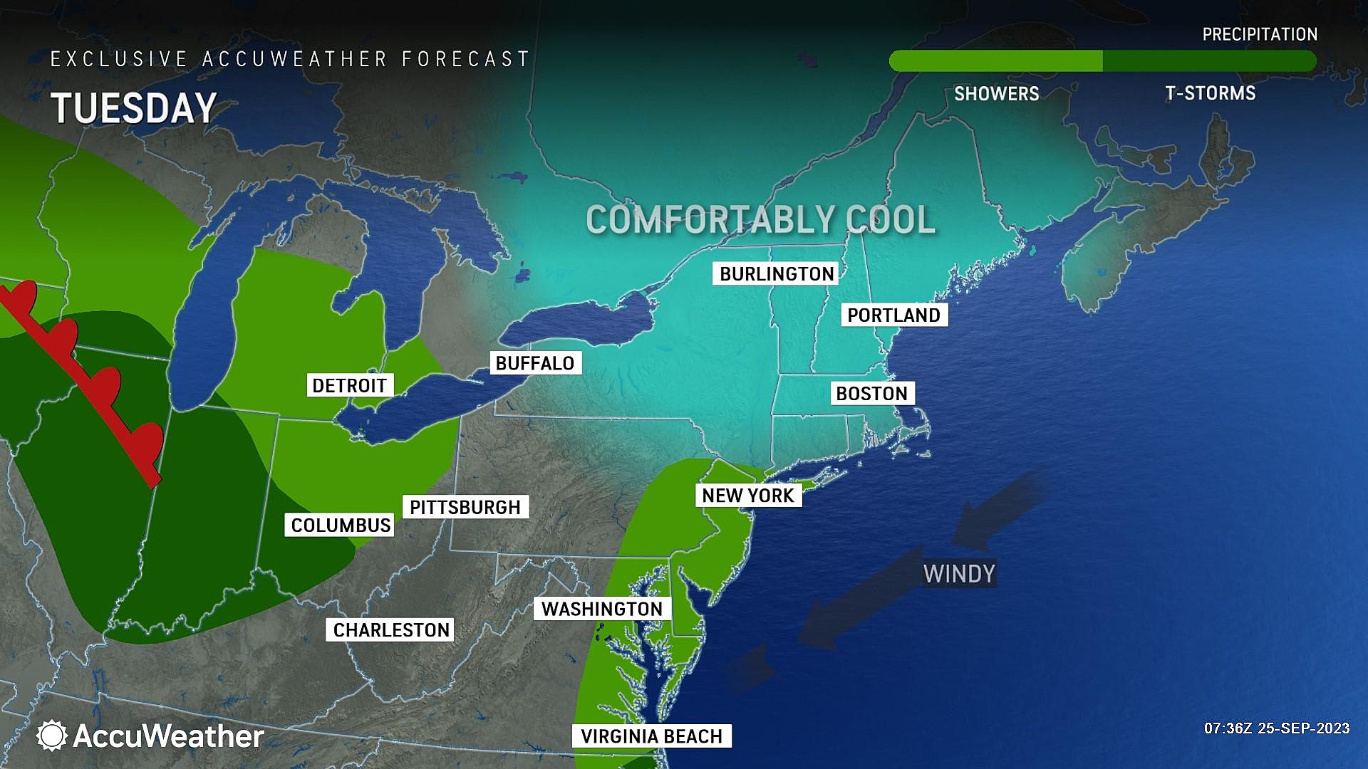
Scattered showers are still possible all-day Tuesday. But they will end eventually, from west to east. Honestly, final raindrops may not fall along the Jersey Shore until sometime Tuesday evening.
Temperatures Tuesday will be especially miserable, only reaching about 60 degrees at the warmest.
Wednesday
I am going to lean toward an optimistic forecast on Wednesday and say it has the potential to be a nice day. (Of course, that description will be pretty lax after 4 soggy days.)
We will still have lots of cloud cover, although I do expect peeks of sun Wednesday afternoon. Especially to the north and west.
High temperatures will still be on the cool side too, with highs in the 60 to 65 degrees. Blame the light on-shore breeze. Keep in mind, normal highs for late September are still in the mid 70s. Not even close.

Thursday
Thursday takes another step in the right direction. We'll see a nice mix of sun and clouds, and highs in the mid 60s. If it were mid-October, I would call this a nice day.
The Extended Forecaast
While we had been watching another potential coastal storm system for next weekend, that has disappeared from model guidance. That's how things work in the 7+ day time frame. And that's why my official forecast only goes on five days.
I now like what I see for next weekend, as we make the transition from September to October. Temperatures return to the 70s with abundant sunshine? Sounds like a fantastic early fall weekend to me.
Our next weathermaker would be a strong cold front to watch in the Monday-Tuesday time frame next week.
Tropical Storm Ophelia's Impacts in Ocean City
Gallery Credit: Chris Coleman
2023 Atlantic Storm Names: Is Yours on the List?
Gallery Credit: Heather DeLuca
More From WPG Talk Radio 95.5 FM


