
NJ Weather: Squeezing Out One More Gorgeous Day Then Rain Returns
The Bottom Line
Wasn't Tuesday a wonderful weather day? Wednesday is looking just as gorgeous. But it is also the end of this stretch of lovely low humidity, as unsettled, active weather returns.
With the final weekend of August fast approaching, we have about three or four impulses set to ride through our atmosphere. That will translate to three or four rounds of rain. Some of which could be heavy and steady, potentially producing some rumbles of thunder.
But it's not all bad news. There are no washout days in the forecast. And the threat for flooding and/or severe weather seems low. It is just unfortunate that clouds and humidity will build again, with raindrops potentially extending into the weekend too.

Wednesday
It is practically a perfect morning, as sunshine, very low humidity, and comfortable temperatures will greet you to start the day. Thermometers dipped into the 50s across most of the state, with 60s along the coast.
High temperatures Wednesday will be very similar to Tuesday, reaching the upper 70s to around 80. Running about five degrees below normal for late August. Humidity will stay low. And the only wind to kick up will be a sea breeze that cranks up in the afternoon.
Also Wednesday afternoon, the sun will start to disappear behind increasing clouds.
New to the forecast, I've had to add a shower to Wednesday evening. Skies will be mostly cloudy overnight. And temperatures stay fairly comfortable, dipping into the mid 60s.
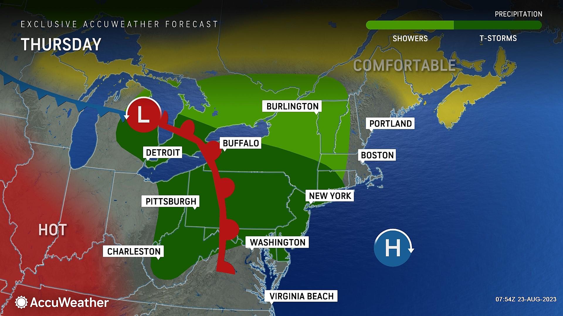
Thursday
Not the greatest weather day, as a warm front then a cold front ramp up rain chances.
The wettest times of the day will be early (pre-dawn through lunchtime) and late (sunset and beyond). In the middle, skies will turn cloudier, a stiff southeasterly breeze will kick up, and humidity will rise.
Pockets of heavy rain are possible, although it's not enough to ring alarm bells at this time.
Because of the raindrops and the clouds, high temperatures will only reach the mid 70s at best. (Some models actually keep thermometers in the 60s all day — an unusually cool, dreary summer day.)
Friday
Still unsettled, but not as "blah" as Thursday.
There will be some peeks of sun Friday. However, the air will also get warmer and stickier. High temperatures will push back into the 80s. And dew points in the 70s will keep you sweating.
Scattered showers and thunderstorms may be an issue on Friday, again especially early and late. Convection potential is especially high in the late afternoon and evening hours, raising concerns for gusty thunderstorms. It will be an "eyes on the sky" kind of summer-ish day.
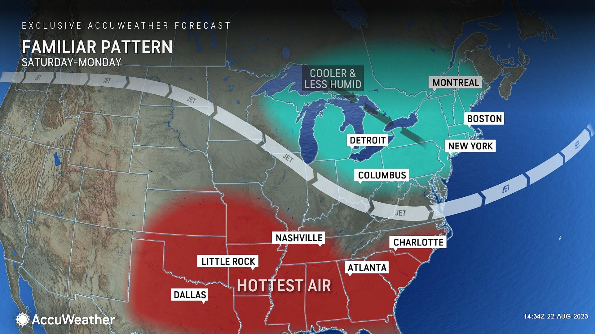
Saturday
One more secondary cold front will push in on Saturday, and then our weather will clear out and settle down a bit.
Unfortunately, it looks like that frontal boundary will produce enough lift for some spotty shower activity during the day Saturday. (I hate having to promote rain chances on a summer weekend.)
I am not comfortable putting a definitive timeline on Saturday's potential showers. But I will say that I don't see anything heavy or prolonged on Saturday. And when there's not rain in the vicinity, skies should be fairly bright — let's call it partly sunny.
High temperatures will reach the lower 80s or so, with moderate humidity.
Sunday & Beyond
Sunday is not guaranteed to be rain-free, but I am going with a dry forecast for now. Partly sunny skies and a northeast breeze will keep temperatures in the upper 70s. Pretty comfortable.
It looks like thermometers will hug the 80-degree mark through early next week. Next chance of rain looks to be Tuesday into Wednesday.
One more note about the tropics. Tropical Storm Franklin is making landfall along the southern shore of the Dominican Republic Wednesday, with impacts also felt in Haiti and the Bahamas. As it enters the open Atlantic later this week, we will have to keep an eye on its trajectory. I still don't think it poses a weather threat to NJ. But the track may come close enough to the Jersey Shore to spit some swell and rough surf our way next week.
LOOK: Cities with the most expensive homes in New Jersey
Gallery Credit: Stacker
More From WPG Talk Radio 95.5 FM


