NJ weather: Still feeling some effects of this weekend’s storm
The Bottom Line
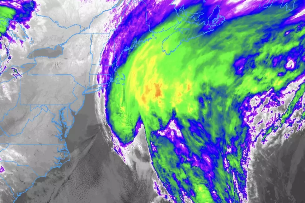
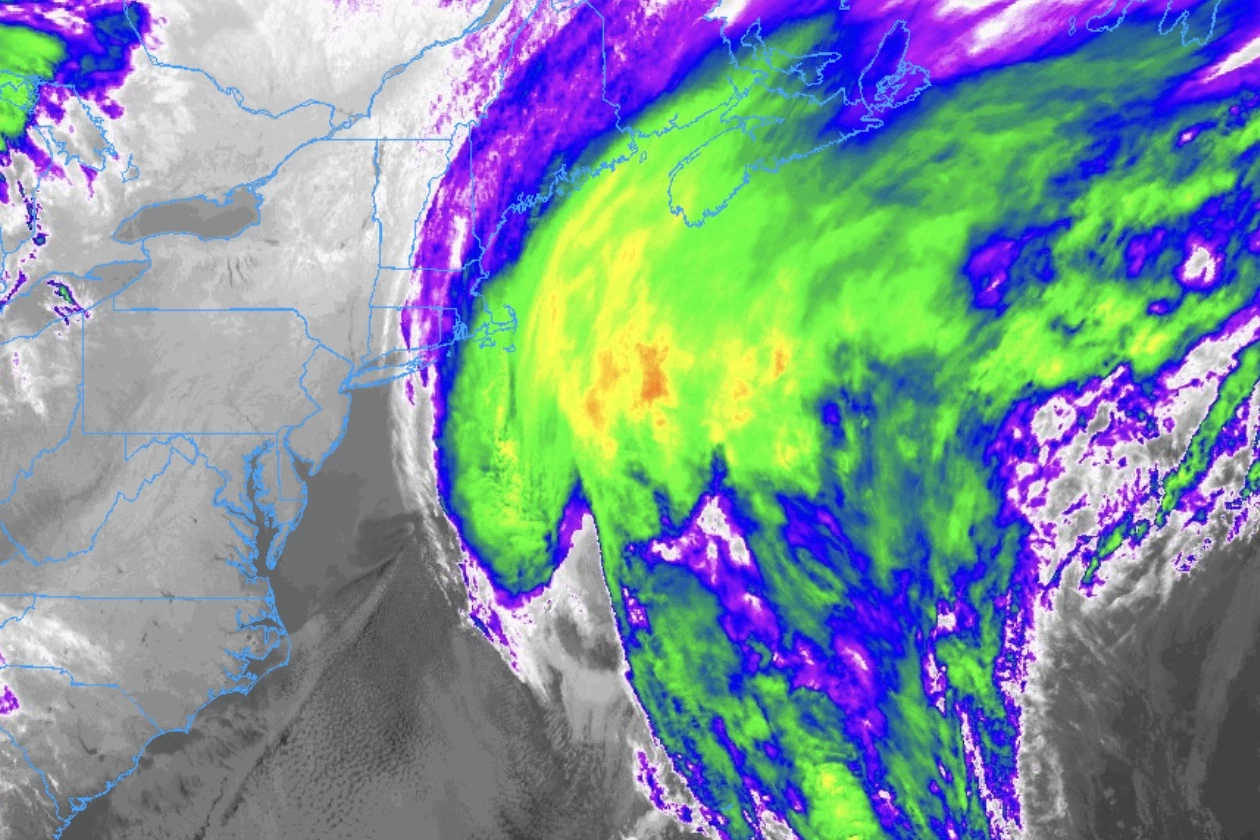
Most weather stations in New Jersey have all but secured a spot in the top five wettest March months on record. Upwards of 4 inches of rain soaked the state again on Saturday. And numerous waterways across NJ are still running high and fast as a result of that rainfall and runoff.
That is not the only lingering impact of that "super soaker" storm system, which is still spinning over the Atlantic Ocean, just off-shore. We also have to talk about a continuing coastal flooding threat. Along with cooler-than-normal temperatures, increasing clouds, and some spotty raindrops coming up.
There's really nothing crazy in the forecast, as we dive into the last week of March. No big warmups. No big cooldowns. No more super soaker storm systems. And definitely no snow. We'll just follow some gentle ups and downs, and some unsettled weather midweek, as the Easter Weekend approaches.

Monday
There is a lot to like about Monday's forecast, even though temperatures will be held a few degrees below seasonal normals. (FYI, the long-term average for late March is approaching the mid 50s.)
We are starting off the new week on the chilly side, with temperatures ranging from the 20s in the northwest hills, to the 30s across most of inland New Jersey, to the lower 40s right along the coast.
High temperatures on Monday will reach about 50 degrees. Similar to Sunday's numbers. You will notice an occasional breeze, especially through the first half of the day.
Otherwise, expect sunny skies and dry weather from start to finish.

Monday night will stay quiet, although clouds will increase from the east. Low temperatures will dip into the mid 30s.
One more important note about both Monday and Tuesday, a Coastal Flood Warning is posted for the Jersey Shore. Over the next 3 or 4 high tide cycles, minor to moderate coastal flooding is likely. (The Monday evening high tide is likely to be the highest crest of all.) This magnitude of water rise goes a bit beyond "the usual spots" picking up a few inches of water. There may be road closures along low-lying areas. Stay alert. And never attempt to drive, walk, or swim through flooded areas.
Tuesday
A little greyer and a little cooler. Although there won't be much weather that gets in your way on Tuesday.
With a continuing northeasterly (on-shore) breeze, clouds will be quite prominent in the sky throughout Tuesday. Hopefully with some peeks of sun along the way.
High temperatures will scale back to the upper 40s on Tuesday. Unseasonably cool.

There is a chance for some pop-up sprinkles and spritzes among that cloud cover Tuesday, especially right along the coast. But the rain will not be steady nor widespread enough to cause issues for any outdoor events and activities.
Wednesday
Our weather will become more and more unsettled as the week goes on.
Wednesday will be mostly cloudy. At least temperatures will bounce back into the seasonable lower-mid 50s.
Model guidance shows a batch of spotty to scattered rain showers developing right in the middle of the day. There is a chance you will have to use the umbrella for an hour or two.
Thursday
One more day of scattered rain chances. And this could be the wettest day of all.
A broad period of rain is looking likely for Thursday, sliding along a cold front slowly progressing across the state. It does not look like a "total washout," just partially wet. The best chance of rain will be along the southern and eastern edges of the state. Thursday will certainly be a cloudy day statewide.
High temperatures on Thursday should once again hit the lower-mid 50s.
Friday & Beyond
A new, slightly cooler air mass arrives on Friday with a "whoosh" of northwesterly winds. Gusts may exceed 30 mph for part of the day.
Skies will brighten on Friday too, becoming partly sunny or even mostly sunny by the afternoon. I am confident it will not get that cold. My latest forecast shows high temperatures only scaling back into the lower 50s.
Saturday actually looks like a perfectly pleasant late March day. Sunshine will give way to late-day clouds, with rain-free weather and a light westerly breeze. High temperatures are forecast to reach the mid 50s. 60 degrees might even be a possibility.
Easter Sunday is trending fine too, although an isolated morning shower can not be ruled out. Expect increasing sunshine, breezy conditions, and high temperatures yet again in the 50s.
Battleship New Jersey is towed for maintenance
Gallery Credit: Dan Alexander
Dan Zarrow is Chief Meteorologist for Townsquare Media New Jersey. Follow him on Facebook for the latest forecast and realtime weather updates.
Get Your NJ 101.5 Merch
Gallery Credit: Nicole Todd
More From WPG Talk Radio 95.5 FM